|
Click here to read the previous part of the trip.
Day 82 â Sunday 12 September 2021 â Parachilna Gorge to Aroona Camping Area, Flinders Ranges NP
Weather: minimum of 10.7ºC and fine
A cool change comes through at 4:45 am and it is overcast at 6:00 am but by the time I get up it is fine. I listen to the 6:00 am ABC news from Adelaide but can find nothing at all at 7:00 am. I finish the SMH from yesterday and get up at 8:10 am.
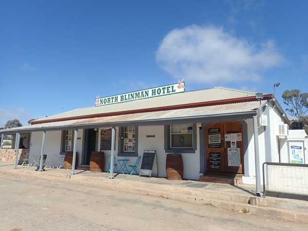 | 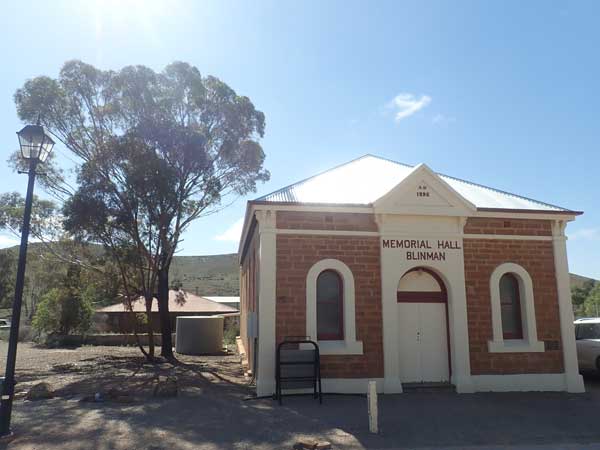 |
| The North Blinman Hotel, actually in Blinman | The Memorial Hall, Blinman |
I have breakfast and then read a book. It is very windy and 50% overcast later. Another 25 or so motorbikes go past this morning, this time heading west. I never do find out where they came from or went. I pack up and at 9:35 am leave. I see some garbage bins and I get rid of a load of rubbish. At 10:05 am I arrive in Blinman, an old copper mining town. This is 19 km from my camp and it is a cool 13ºC.
The town has some very nice buildings, the North Blinman Hotel (1869) and the Memorial Hall are the picks. I go to the cafe/bakery and buy a sticky date scone and a caramel slice for $8. I intend to have these for morning and afternoon teas over the coming days (half each time). I download the SMH and leave town at 10:40 am.
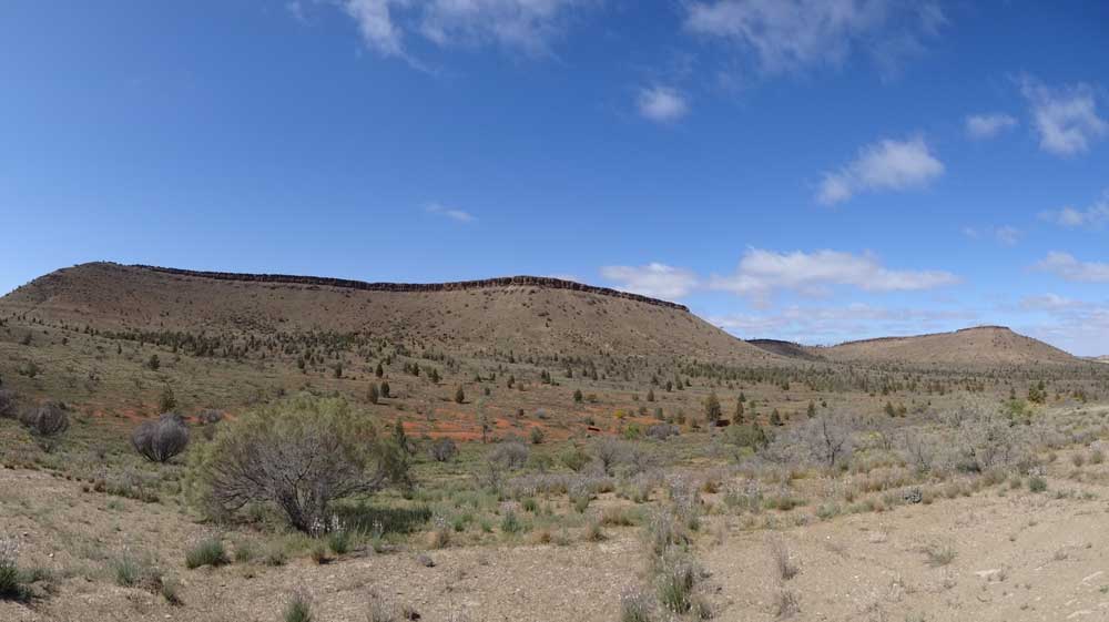 | |
| The Great Wall of China, pretty spectacular |
At 10:52 am I arrive at the Great Wall of China. This is a plateau type hill that is very spectacular, an amazing rock formation. I have morning tea here with half of the scone. It is excellent! The road from Blinman to the south is tar, while it was dirt from Parachilna to Blinman. I leave at 11:03 am.
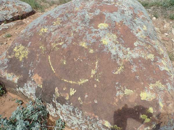 | 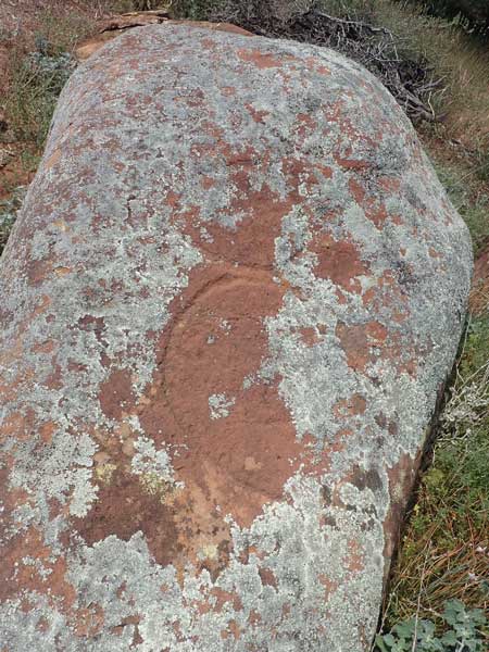 |
| Adnyamathanha Art Site | Adnyamathanha Art Site |
At 11:23 am I arrive at the Adnyamathanha Art Site. There are some peckings here, but they are very average. It is still only 15ºC. I leave at 11:40 am and backtrack to Brachina Gorge Road which is the access road into the northern part of Flinders Ranges NP. At 11:52 am I arrive at Yongoona Ruins and Waterhole. There is not much here, a chimney is about all.
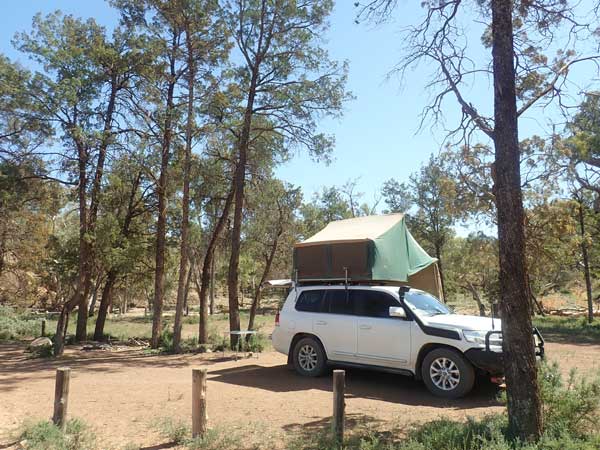
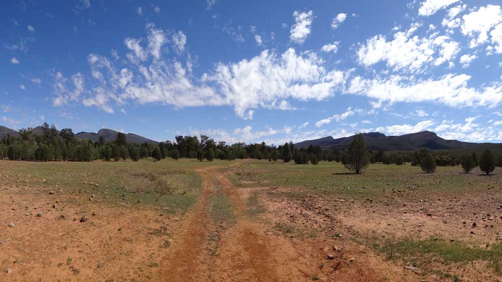
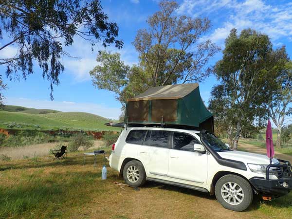
I leave at 11:57 am and go via the grave of Emma Smith. The road into Aroona Camping Area is the Aroona Valley Road and it comes off just after a creek crossing. I arrive at the Aroona Camping Area at 12:35 pm. I find my camping site which I had to pick when I booked. I did good, it is a very nice spot. There are toilets here as well as piped water. I have no idea why they connected water way out here.
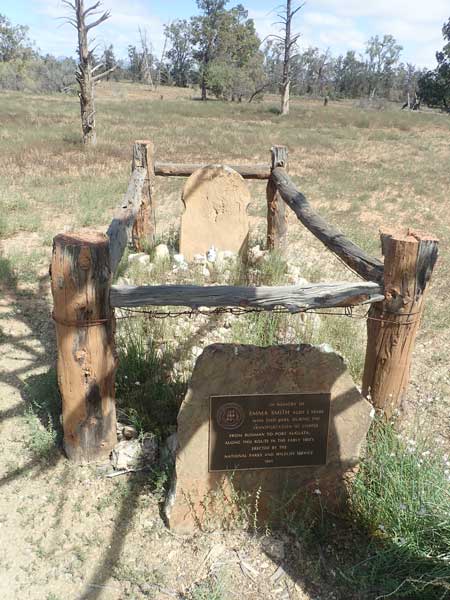 |  |
| Emma Smith's grave | My campsite at Aroona |
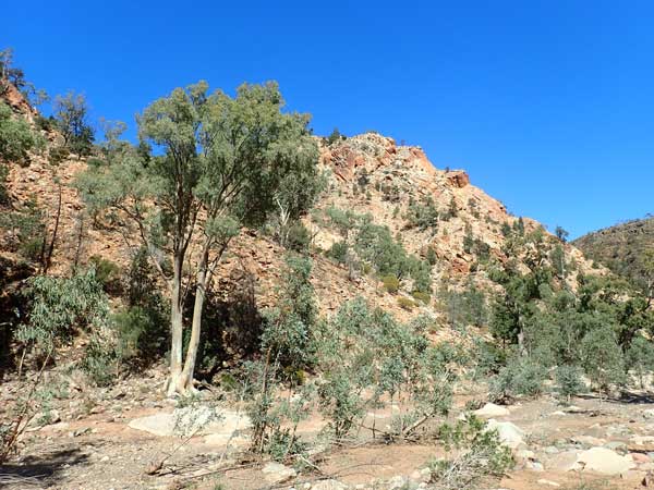
I have lunch and at 1:20 pm I head off on a walk. This is called Yuluna Circuit. This is an easy walk, 8.7 km. It heads south along the Yuluna Creek to near the Koolamon Camping Area and then follows another creek to the east. This is all flat. From here the walk climbs a little and then back across the same ceek and then climbs again. You then come to a fire trail called Bulls Gap Track. You follow this to the west and are supposed to take a turn to the left for the next bit of the track but I do not see the turn. I end up just following the track and get back to the camping area. On the walk I see two emus and four chicks as well as a shingleback lizard. I am back at 3:20 pm.
The wind drops a little and I have a cuppa. After this I walk to the nearby Aroona Homestead ruins. There are the footings and a cellar. The interpretation signs are rubbish, they give no real information about the homestead at all.
 | 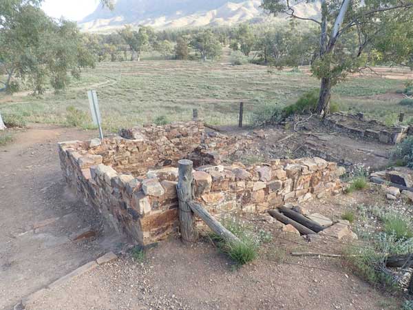 |
| Yuluna Creek on the walk | Some of the ruins of Yongoona Homestead at Aroona |
I am back at 5:00 pm and I start a fire and have drinks. I cook sausages and sweet potato on my skillet and have with leftover fried rice. It is now windy again and freezing cold. Everyone in the camping area goes to bed before 7:30 pm and I am in bed by 8:00 pm. It is 8ºC but feels like -5ºC! There are only three other groups camped here.
Note: Some of the camp sites in South Australian NP camping areas hold more than one vehicle per site, this is important to know if you are travelling in a group.
Weather: Fine, maximum of 15ºC
Arrived: Aroona Camping Area Time: 1:05 pm Distance: 62 kilometres
Day 83 â Monday 13 September 2021 â Aroona Camping Area to Trezona Camping Area, Flinders Ranges NP
Weather: minimum of 1.9ºC and fine
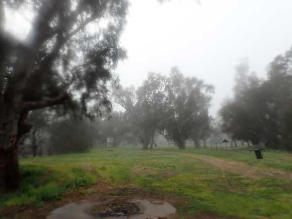
The wind drops about midnight and it is calm for the rest of the night. It is, however, very cold. I wake at 2:15 am and am awake till at least 4:45 am. This really shits me, I am tired but at times I stay awake for hours. I end up sleeping till 7:10 am, very late for me. There is no phone coverage here so I cannot read the paper. I get up at about 7:30 am.
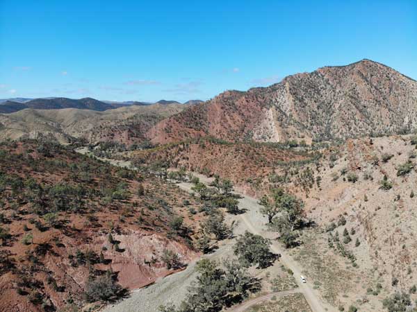
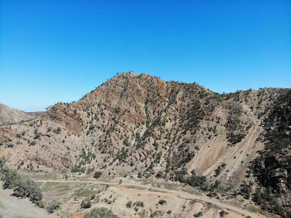
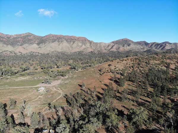 | 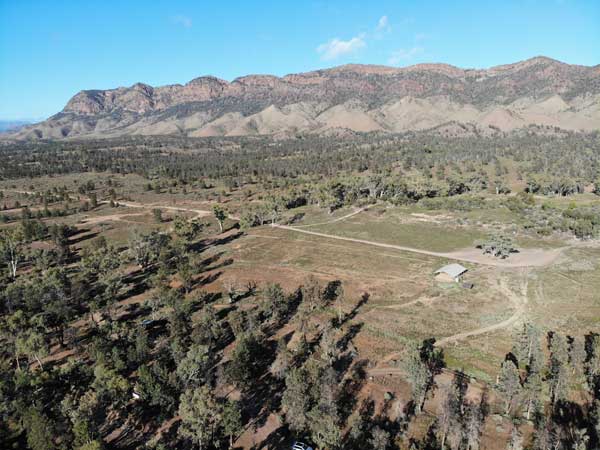 |
A drone shot looking to the south-west at Aroona, my campsite
is in the trees at bottom, you can see my car | Looking west at Aroona, you can just
see my car towards the bottom left |
I fly my drone while there is no wind and then have breakfast. I fill my water tank from my container and then fill this as there is tap water here, strange considering it is a long way from any civilisation. I read my Kindle and the wind picks up a little by 8:40 am.
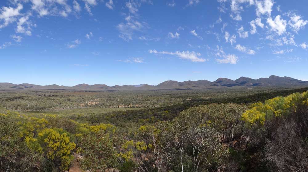
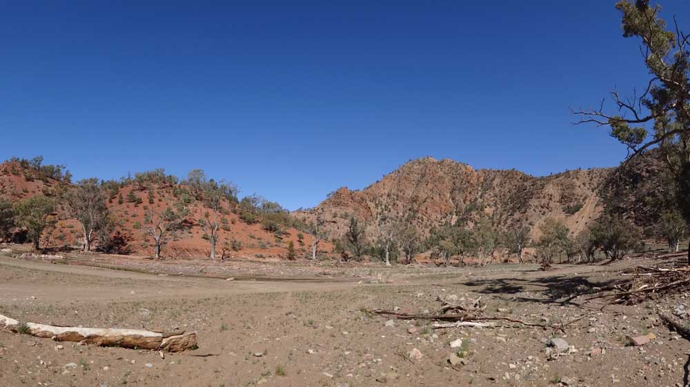 |
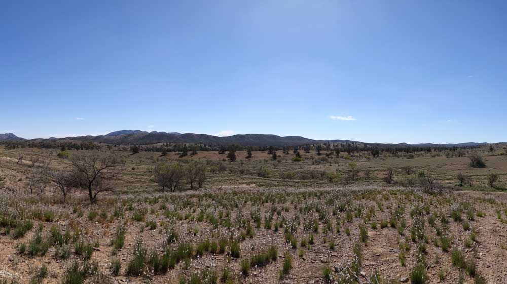
| A panoramic photograph of a section of Brachina Gorge |
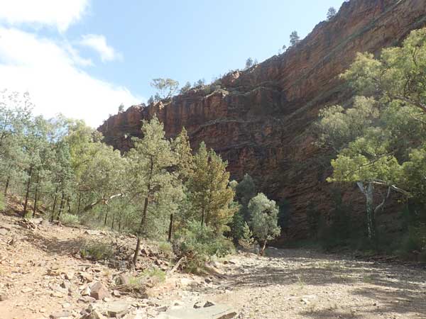
I leave at 9:50 am, it is still only 13ºC. I go to Brachina Gorge via the camping area and Brachina Gorge East. I arrive there at 10:40 am, 20 kilometres from my campsite. The main gorge is spectacular, with the rocks orange and red. The geology is like all this area, simply amazing. On the way back out I stop near a lookout at a table and chairs for morning tea. I also fly my drone.
 |  |
| A drone shot of Brachina Gorge | Another drone shot of Brachina Gorge |
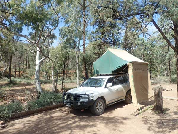
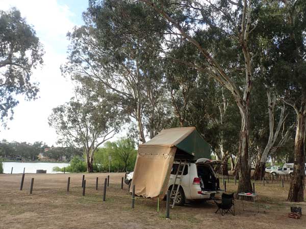
It is still cold when I leave at 11:05 am. At 11:22 am I arrive in Trezona Camping Area, 29.5 km from Aroona. The camping area is on Enorama Creek. I find my camp site, it is a good spot. The camping area is also very good. I have a look around and work out where the walk starts and pick up some pieces of wood to start my fire this evening.
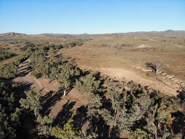 | 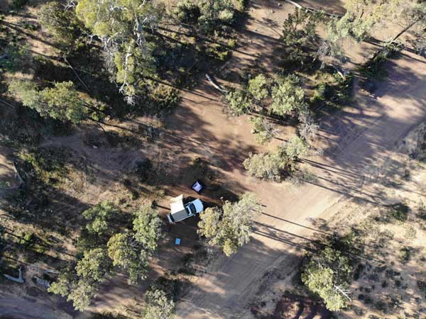 |
| A drone shot of Trezona Camping Area looking east | Looking down at my campsite at Trezona |
I set up my camp and then have lunch. There are only two other vehicles here. I head off on the Trezona Circuit walk at 1:00 pm. The walk is 9.1 kilometres and is very easy. The track starts near the start of the camping area. I go along the creek first rather than to the south-west. As you follow the creek there are a number of geological markers that explain significant things to see. After a kilometre or so you cross the creek and climb a small hill. Another kay on and there is an intersection and you drop down back into Enorama Creek. On the way down there are fossil stromatolites, some of the earliest life on earth.
 | 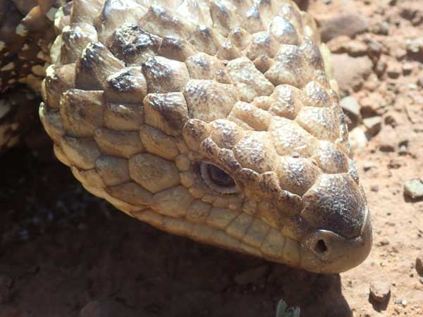 |
| My campsite at Trezona Camping Area | A shingleback lizard I saw on the walk |
You then follow the creek for a while and then come up out to the ruins of Youngoona Hut. This is from when cattle were run here. You then cut over to Brachina Gorge Road and cross it. The walk is now on Yanyanna Track. You go down a small hill to Etina Creek. After crossing you go over a small hill to Middlesight Water Hut. This replacement hut still exists and was originally a musterer's camp.
From here you follow a creek which then becomes Etina Creek. You then cut up over a small hill to the main road again. From here it is a flat run across old paddocks to the camping area. The brochure says the walk is 8.0 kilometres, but I did 9.1 km. I am back at 3:05 pm. I saw more emus and chicks on this walk.
 |
| A panoramic photograph taken on the Trezona walk |
I have a cuppa and read while in the fly tent as there are lots of flies again. There is an emu around the camping area and also some ring-neck parrots (lots of others but these are rarer). At 4:15 pm I start the car as I want to heat water for a shower. The radiator temperature is 33ºC when it starts. Normally it would only take about five minutes to heat water for a shower if you do it as soon as you stop at the campsite. It takes 15 minutes today to get the car hot enough to heat the water enough to have a shower. I heat the water in the container to 45ºC and then turn off the engine. When I use the water, it ends up coming out at about 38ºC.
Three more vehicles come in to the camping area. At 5:00 pm I put the fire on and have drinks. At 6:00 pm I put more Mongolian lamb on and have it with more rice. The wind tonight is lighter than the past few days but there is the occasional stronger gust. It is cold, but 100 times better than last night. It gets a bit windier at 9:00 pm but still okay. I go to bed at 9:30 pm.
Weather: Fine, maximum of 18ºC
Arrived: Trezona Camping Area Time: 11:22 am Distance: 30 kilometres
Day 84 - Tuesday 14 September 2021 - Trezona Camping Area to Wilpena Pound
Weather: minimum of 2.6ºC and fine
Another cold night and I sleep fairly well although I am awake for an hour from 4:00 am. I read some and this helps me get back to sleep. At 6:15 am I am awake and I read more. I listen to the ABC news at 7:00 am. I get up at 7:25 am and it has warmed to 8ºC. There is no wind. I have breakfast and leave at 9:00 am.
I head west back the way I came yesterday and then south on Bunyeroo Valley Geo Scenic Road. I stop at the Cambrian Camping Area to have a look. It is weirdly laid out and very average. I continue on and have a look at Acraman Camping Area. This is small and nice, but only suited to tents and rooftop tents. At 9:35 am I stop at Twin Gums Lookout which is a bit useless but it does have tables and chairs. Next to here is the trailhead for the Bunyeroo Gorge Walk where I arrive at 9:37 am. It is 17 km to here.
 |  |
| Bunyeroo Gorge | Bunyeroo Gorge |
This walk follows Bunyeroo Creek and is very interesting. There are leaflets at the start and they give a very good description of the walk and the geological features. There are geological markers along the way indicating the features. I walk about 2.5 kilometres and then return. All up I do 5.1 km and am back at the car at 10:55 am. I have morning tea here.
I leave at 11:10 am. My stupid Toyota GPS wants to go via the Wilcolo Walking Track which is not a road! Anyway, five minutes later I stop at the Bunyeroo Gorge Lookout which has great views to the south. A further 900 metres on is Razorback Lookout which is better. Then another 1.1 km on is Bunyeroo Valley Lookout which has great views nearly all around. I talk to some people here for ages.
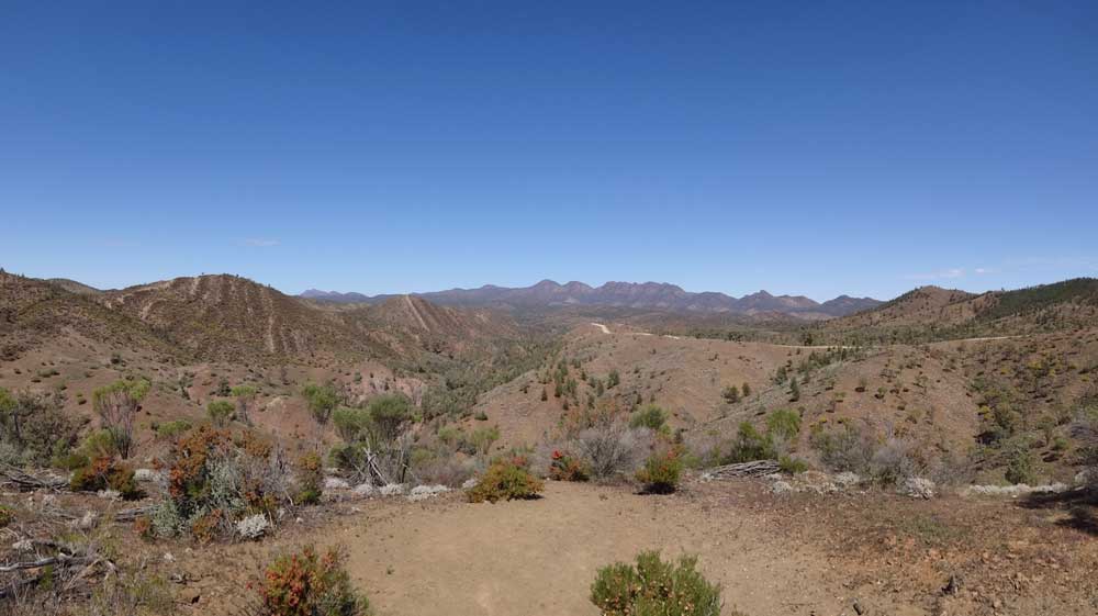 |
| A panoramic photograph taken at Razorback Lookout. The view is to the south towards Wilpena Pound. |
I leave at noon and at 12:25 pm I stop at Wood Duck Dam, 39 km from my start. It is a cool 16ºC. There are tables here so I have lunch. As I leave, I drop my rubbish in the bins. Just before here I got phone coverage for the first time since Sunday morning. There are still lots of flies. I leave at 12:40 pm.
At 12:50 pm I arrive at Wilpena Pound and book in. I do not have a booking as I booked for back in June when I should have been here. I explain that I booked and paid for two nights and show them my receipt. They give me a site without me paying again. It takes 15 minutes to book in as they are fairly busy. I head into the camping area and go around the whole area a few times. There are lots of people here, including some large school groups.
At 1:15 pm I finally settle on my spot in amongst some small trees and relatively close to the toilet blocks. While I am here, Ron and Donna phone, they are back in Queensland and now near Barcaldine. They are heading to Lara Wetland and then to the coast as they have a wedding that they want to attend in a few weeks. I first take my washing to the laundry and put a load on. I set up camp after this and read till my washing is finished. I put this on the clothes line.
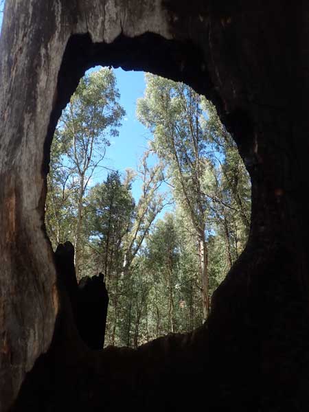 | 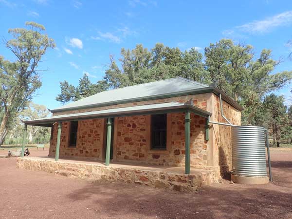 |
| A tree on the track today | Halls Homestead in Wilpena Pound |
It is now 2:15 pm so I head off on a walk to Wilpena Pound itself. This is a very easy walk along the creek. Once in the Wilpena Pound I go to the Halls Historic Site. This is an old restored homestead from when cattle were run here. I get back to the car at 4:05 pm, the walk was 7.1 kilometres. I then go to the reception to get some more $1 coins so I can put more laundry on tomorrow. I then go to the bar as I was going to have a beer there, but it was very uninspiring so I walked back to my car. All up I have walked 12.9 km today.
I have a cuppa and read the SMH and at 5:00 pm I have a shower and collect my washing off the line. It is mostly dry but some things are a little damp. I will dry them a bit more tomorrow. I start a fire at 5:30 pm and have drinks and nibblies. I cook tandoori chicken and potato on my skillet over the fire.
It is cool but there is no wind. I work out the rest of my trip's itinerary and think I will stop at Kylie's (she grew up with my younger sister and lived near us) place on maybe the 18th or 19th. I let her know. I go to bed at 9:40 pm.
Weather: Fine, maximum of 17ºC
Arrived: Wilpena Pound Time: 12:50 pm Distance: 46 kilometres
Day 85 - Wednesday 15 September 2021 - Wilpena Pound
Weather: minimum of 7.8ºC and fine
It rains from about 11:30 pm till 3:30 am, only drizzle. Then it rains heavy from 4:10 am for 15 minutes and then rains lightly from 5:30 am till 6:00 am. The minimum temperature overnight was at about 9:45 pm last night! I wake at 7:00 am and read the SMH till I get up at 8:10 am. It is now sunny so I put my solar blanket out and my washing on a rope to dry further. I end up not doing any more washing.
I have breakfast and at 9:50 am I head off on a walk to Wilpena Pound. I go via the toilets and have food with me for the walk. I intend to walk into the middle of the pound and up one side, basically part of the St Mary Peak walk but I overestimate the accuracy of the leaflet maps as it turns out. The walk goes the same way as the walk I did yesterday.
 |
| A panoramic photograph taken from the floor of Wilpena Pound |
Once in Wilpena Pound I head out on the track across the floor of the pound (it is a synclinal basin which basically means it is like a crater). There is only one easy way in or out and that is the way the track comes from the Wilpena Pound Resort. The leaflet seems to show it is not far across, but in reality it is a long way. I walk over three kilometres into the pound without even getting close to the other side. I think I was still 8 kilometres from St Marys Lookout when I head back. My feet are starting to hurt, my toes especially.
 |
| A panoramic photograph taken from Wangarra Lookout looking south-west over the floor of Wilpena Pound |
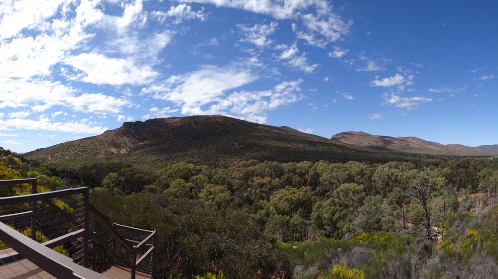
Back at the Halls HS, I take the walk to the Wangarra Lookout. This is a steep and harder walk, although it is not all that long and is well worth the effort. The views from the lookout are great (there are two, a lower one and a higher one). I walk back to the camping area, getting back at 1:10 pm. I walked 13.1 kilometres. I check out my feet as I have lunch and there are blisters on my two little toes. Bugger! I have walked as far or more many times on this trip without any problems.
 |
| A panoramic photograph taken from Wangarra Lookout looking to the east and the walls of Wilpena Pound |
I read and relax. I have no idea why I have blisters, I think that perhaps the socks I used are coarser than the normal ones I use. At 3:20 pm I walk to the IGA supermarket near the reception. It has a pretty good range of things, in fact, I should have purchased stuff from here today rather than tomorrow. I get an ice cream, a new Coco Pops Gaytime. It is really nice.
I am back at 3:50 pm. I have a cuppa and then do some more work on my itinerary. I plan to get back to Sydney on Saturday 25 September. I pack my clothesline and solar blanket away. At 5:00 pm I go to the showers and then at 5:30 pm I put the fire on and have drinks. I cook the last of the Mongolian lamb I have. There is no wind but it is cool. I go to bed at 9:45 pm and it is 8ºC.
Weather: Fine, some cloud, maximum of 19ºC
Arrived: Wilpena Pound Time: N/A Distance: 0 kilometres
Day 86 â Thursday 16 September 2021 â Wilpena Pound to Ippinitchie Camping Area, Wirrabara
Weather: minimum of 3.9ºC and fine
A car comes into the camping area at 1:00 am and the people stay up drinking till at least 3:00 am. They are very noisy. I am awake at 6:00 am, having had a fairly good sleep despite these idiots. I listen to a couple of ABC Radio news and read the SMH. I change the sheets on the bed (easier to do now) and get up at 8:10 am. I cook a bacon sandwich for breakfast. I pack up and fill my water tank from one of my containers. I drive over to the toilet block and fill the containers.
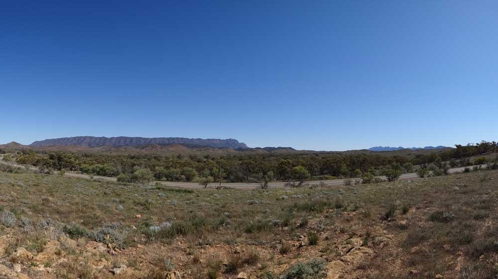 |
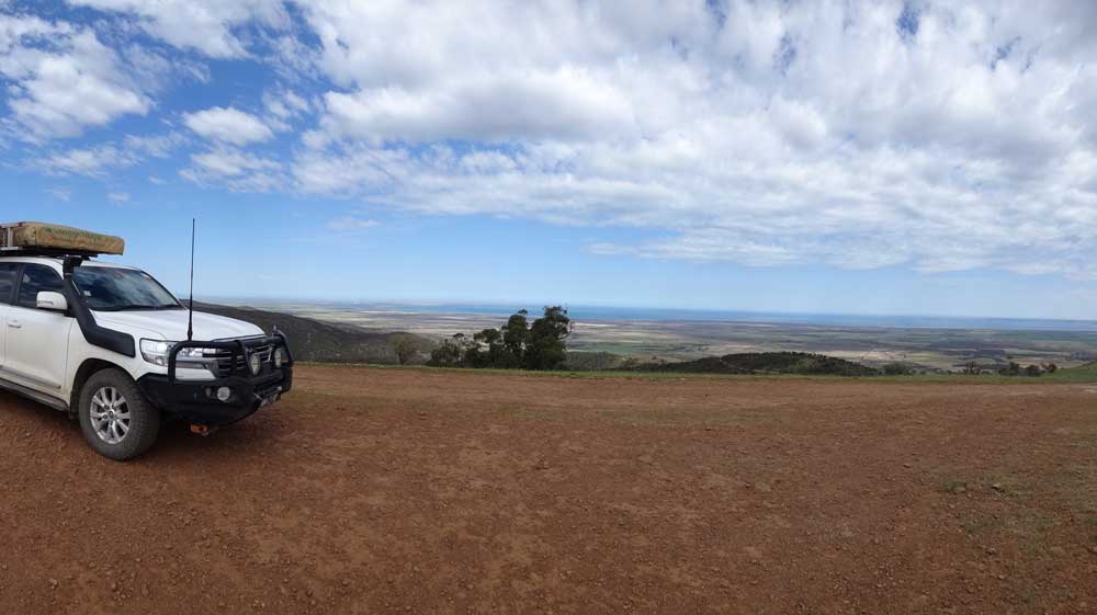
| A panoramic photograph taken from the Elder Range Lookout looking west at the Elder Range |
I leave at 9:55 am and at 10:20 am I stop at the Elder Range Lookout. This is 31 km from Wilpena and has great views to Elder Range to the west. It is a warm 21ºC now. I leave a few minutes later after taking some photos.
At 10:42 am I arrive in Hawker, the gateway to the Flinders Ranges (56 km). I do some shopping (only $13) in the small supermarket and then go to the park near the war memorial and have morning tea. This is quite a nice park and the memorial is good too with some interesting soldier statues. I leave at 11:00 am.
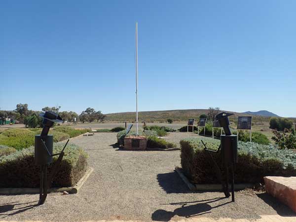 | 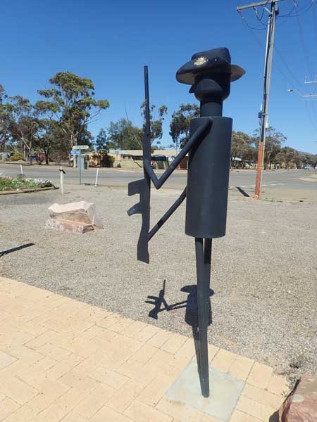 |
| The Hawker War Memorial | A closeup of one of the soldier sculptures |
I head south on the Flinders Ranges Way. At 12:38 am I stop at the Kanyaka Historic Site. This is the ruins of the Kanyaka Homestead and is quite extensive. It sure must have been a really rich property back in the day. There are the homestead, stables, huts, a large shearing shed and quarters and more. All are made from local stone (granite I think). I fly my drone to get some photos. I leave at 11:50 am.
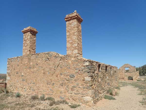 | 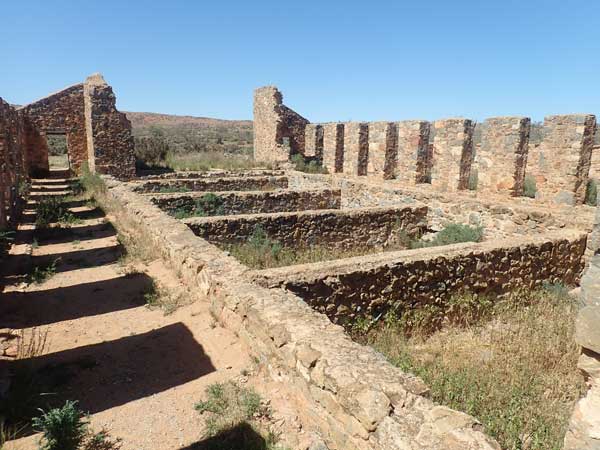 |
| The Kanyaka Homestead with the stables behind | The Kanyaka shearing shed |
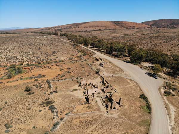 | 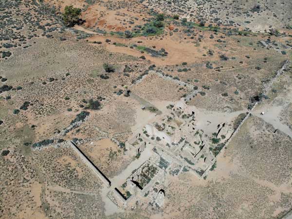 |
| The Kanyaka Homestead precinct | Another shot of the Kanyaka Homestead |
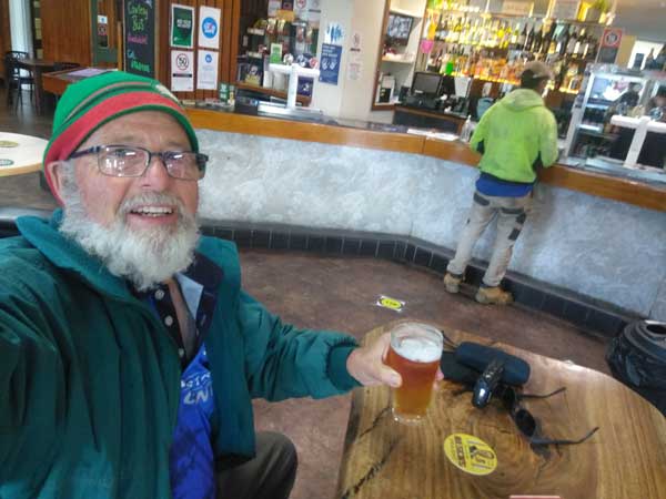
At 12:20 pm I arrive in Quorn, 125 kilometres from Wilpena. I go to the Continental Hotel and have a hamburger and Coopers Pale Ale, $23 special. There is a 10% seniors discount too! It was very nice, well so was the beer. After this I go to the chemist as I have a sty on my lower left eyelid and it is very annoying. I can even see it. He says to just put a warm compress on it and use eyedrops. I do this and eventually it heals, but it takes a long time. This is the first one I have had for 40 years I reckon.
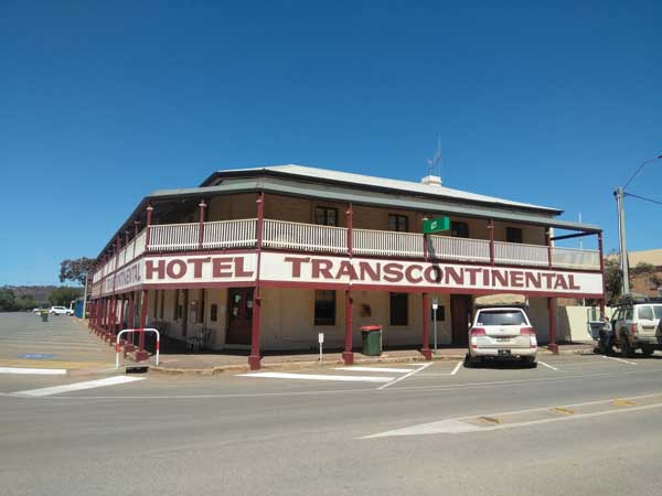 | 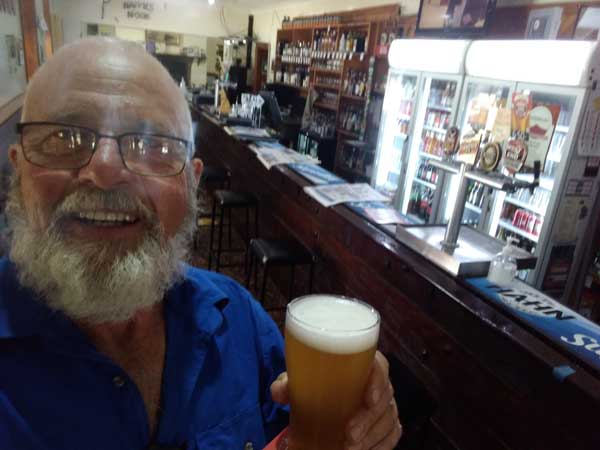 |
| The Transcontinental Hotel in Quorn | Another day, another town, another pub and another beer |
I drive around the town looking at the nice buildings. There is a great Catholic church, town hall and court house. I leave at 1:20 pm.
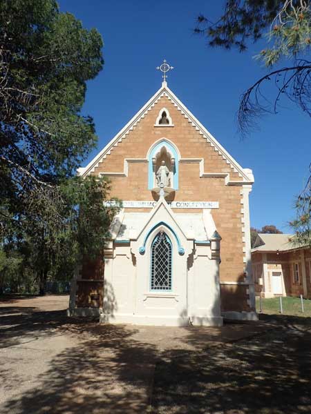 | 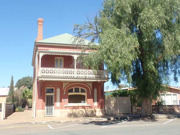 |
| The Catholic Church in Quorn | A nice house in Quorn |
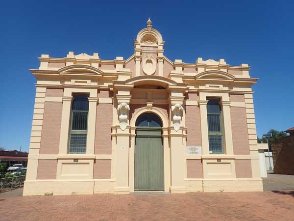 | 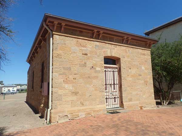 |
| The Quorn Town Hall | Quorn Court House, built 1879 |
At 2:00 pm I arrive in Port Augusta (170 km). I have really only come here to see if I can get a new mobile phone. A week or so ago I dropped my phone again and totally smashed the screen. It is hard to read and the camera is partially covered by a crack. However, I can find no electronic store (I Googled yesterday too without luck) and only a Big W which I know does not have the phone I am after (a Nokia but more than basic). I leave five minutes later and head south on the Princes Highway.
South of town I take the Horrocks Pass Road and then the Horrocks Highway. At 2:45 pm I arrive in Wilmington and stop at the Centenary Park. I have afternoon tea here and also sharpen my chainsaw. I leave at 3:00 pm. On the way I look at a few possible camp sites but decide against them.
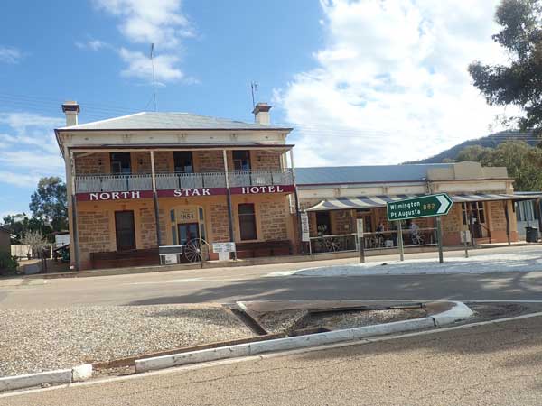 |  |
| The Wirrabara North Star Hotel | Ippinitchie Campgrounds |
At Wirrabara I turn off to the right and head out to Ippinitchie Campgrounds. This is supposed to be state forest but once I get there it seems it is about to become national park. Anyway, I arrive there at 3:50 pm. It is fairly nice and also pretty full (some areas are very wet and not useable). I pick a spot and put my table and chair there. I head back out to the road and find some timber and cut it. I am back at 4:10 pm.
I set up camp and nearby campers tell me that yesterday people came and changed all the signs and camping layout for no apparent reason. As it happens, tomorrow it becomes apparent the whole area is to become an national park. Anyway, I have a cuppa and at 5:30 pm I put a fire on and have drinks. I am not really hungry after lunch, so I have have a cheese and vegemite jaffle and a CupaSoup.
It has been overcast since 3:45 pm and at 5:00 pm there were a few spots of rain. I go to bed at 9:00 pm and it is clear again. It is very windy up high but calm on the ground.
Weather: Fine, maximum of 25ºC
Arrived: Ippinitchie Camping Area Time: 3:50 pm Distance: 214 kilometres
Day 87 â Friday 17 September 2021 â Ippinitchie Camping Area to Broughton Creek, Spalding
Weather: minimum of 13.3ºC and overcast
It is very windy the whole night but protected here. It must have come over cloudy as it was a warm night. I get up at 7:55 am after the usual radio and SMH. It is still overcast. I go to the toilet and find there is no paper! I won't go into detail, but leaves had something to do with it. I go back with a roll of toilet paper. Serves me right for not looking first. I have breakfast.
I leave at 9:20 am with the intention of going to the Bluff which is a lookout that has views over Spencer Gulf. However, after driving past a new picnic area (with all fancy chairs set out for some official gathering), and along a freshly graded road with new Armco fencing, I am stopped by a park worker who says it is closed due to an opening ceremony. Why could they not have put a sign back near the camping area, I wasted 30 minutes of my time and 20 kilometres.
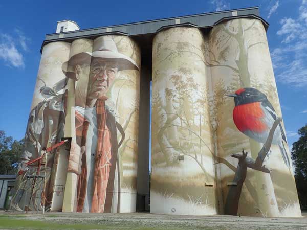 |  |
| The murals on the Wirrabara silos | Part of the Wirrabara township |
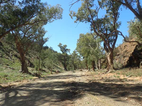
I turn around and get back to Wirrabara at 9:50 am. I stop at a silo with a mural on it and then go to the bakery. I buy a lamington for morning tea. Last night some fellow campers told me about a 4WD track called the Bridle Trail that goes from up here down to the water level. Yesterday I saw a couple of signs to it. I head back north and take the Germein Gorge Road and then down that a few kilometres, I turn onto Survey Road which is the start of the Bridle Track.
 |  |
| Part of the Bridle Track looking towards Spencer Gulf | Stopped on the Bridle Track |
The track goes through farming properties and then follows the top of the ridge. Here there are fantastic views to the west over Spencer Gulf. I stop at a spot and cut some dead timber and then at the highest spot for morning tea. It is 10:55 am and I have travelled 23.6 kilometres from Wirrabara. You can see clearly across to Wyalla. Along the track I have seen a snake, a shingleback lizard and two wallabies. I leave at 11:06 am and soon do a steep descent where I need 4WD.
 |
| A panormaic photograph from the peak of the Bridle Track looking across Spencer Gulf towards Wyalla |
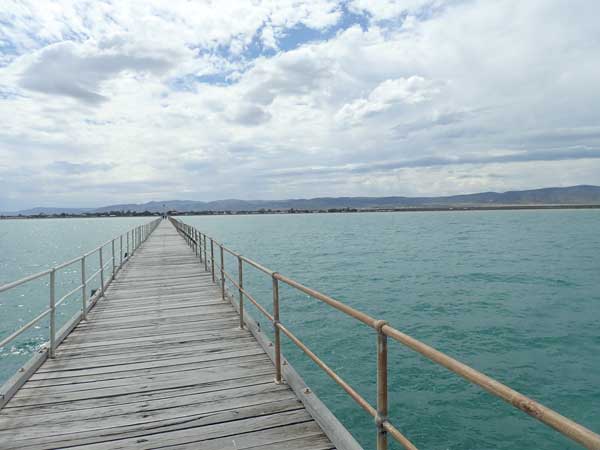
I finish the track at 11:25 am. There were five gates to open and close. It was a very nice drive and I am glad that I did it. Back at the Princes Highway, I decide to go to Port Germein. This has a very long pier, supposedly the longest in the state. I walk out to the end. It is not very wide at all, and the last bit is closed due to damage. There is also a small lighthouse and an interesting tidal gauge clock which shows the tide.
I walk 3.1 km all up. I go back to the car and have lunch in the park next to the start of the pier. Quite a nice spot, but cool.
 | 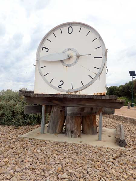 |
| The Germein Pier stretching out into Spencer Gulf | The tidal clock at the start of the pier |
After lunch I go to the Port Germein Hotel which is made of local rock (basalt I think). I have a West End Draught for $7.50, the first I have had in 30 or more years. It was not too bad. I leave at 1:02 pm and head back south on the Princes Highway. I go to Port Pirie (1:25 pm) and again look for an electronic shop but there is nothing. I refuel, 79.4 litres at $1.419 for a total of $112.65. I have averaged 12.9 l/100 km for the 617 km since Leigh Creek.
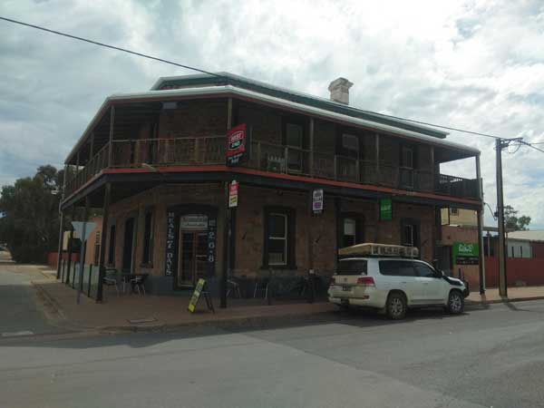 | 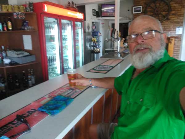 |
| The Germein Hotel | Yet another beer in a pub |
I leave at 1:35 pm. I take the Princes Highway south again and at the intersection with the Goyder Highway I turn left. This leads to Crystal Brook and then at the Horrocks Highway I turn right and then a short distance on I turn left back onto Goyder Highway. About 10 kilometres on I turn right onto Frome Crossing Road. About 6.6 kilometres along I come to Broughton Creek. Immediately I cross the creek I turn left into a track. This is a free camping area, about 250 metres long between the creek and the property. On the way I also stop to cut timber. It is 2:50 pm.
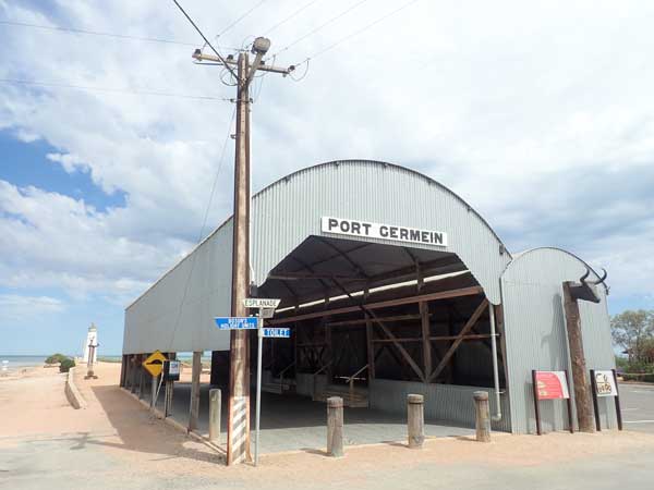 |  |
| The Port Germein Pier building | My campsite at Broughton Creek |
This is a very nice spot along the flowing creek. There is room for five small groups or cars. There is a caravan here as well as a small motorhome. Later a car comes in and camps closer to me. I set up camp and after I heat water for a shower. It is very windy and I have to tie the awning down with double pegs. I then have a cuppa.
I then go for a walk up the road a little, the wind is even stronger there. I come back to the campsite and start a small fire at 5:30 pm. At 6:10 pm I put chicken Tandoori winglets on in the small camp oven. I put the first lot away for meals in coming days and then do the second lot. I have these for dinner.
The wind drops a bit about 7:15 pm and the sky clears up (cloudy for a few hours). I listen to the NRL, Manly thrashes Roosters in the first preliminary semi-final. I also discover that Souths are playing next Friday rather than Saturday. I will now need to be home on Friday so I can watch it. I go to bed about 9:30 pm.
Weather: Fine, maximum of 23ºC
Arrived: Broughton Creek, Spalding Time: 2:50 pm Distance: 165 kilometres
Day 88 â Saturday 18 September 2021 â Broughton Creek to Manoora
Weather: minimum of 6.9ºC and fine
There were a few spots of rain during the night, but the wind which was blowing very strongly again just after I went to bed finally dropped but came up again about 5:30 am. The blokes near me who were in swags left about 8:30 pm, I thought they went to the pub, but they must have had enough of the wind. I sleep on and off till 7:00 am. I read the SMH and get up at 7:55 am.
I have breakfast, it is cold as the wind is strong and it is only 10ºC. I sharpen my chainsaw. Everyone is now gone, they all left early.
 |  |
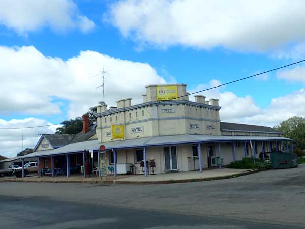
| The Spalding Hotel | The possible camping area south of Spalding on Broughton Creek |
I leave at 9:35 am and go to Spalding. This has a nice looking hotel, town hall and community hall. I leave Spalding and as I head south I notice an area to the left of me just out of town. I go and have a look and find that this would be a great spot to camp. There is a fireplace and table. There are no signs saying you cannot camp here. It is not in WikiCamps.
I travel on the Horrocks Highway and arrive in Clare at 10:28 am (49 km). This is the centre of the second major wine area in South Australia. I go to a hardware store and purchase some butane bottles and then to a chemist to get a cloth mask to replace my disposable ones. I buy a nice caramel slice in the bakery too. I then go to the park nearby and have morning tea with half the slice.
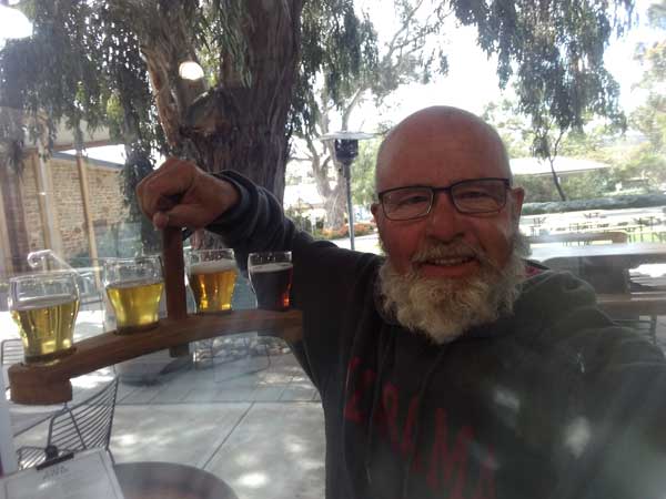
I leave at 11:25 am and at 11:45 am I see Pikes Brewery which I had been looking for. I go in and have a tasting paddle of four beers ($15). They were pilsner, pale ale, IPA and Red IPA. All were nice. I end up buying 12 pilsner and 12 pale ale for $70 to take home. I leave at 12:20 pm. I ring Ged my neighbour and he is at one of the breweries near our places. I tell him I will be home about Thursday or Friday and ask him to turn my hot water back on on Wednesday. I also tell him I have some beers to sample once I am home.
 | 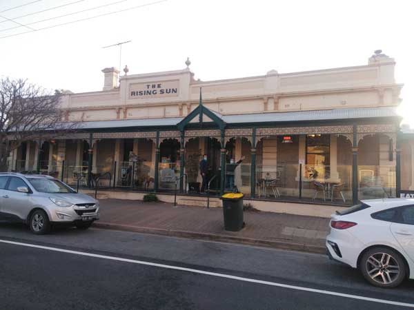 |
| The tasting paddle at Pikes Brewery | The Rising Sun Hotel in Auburn where we had dinner |
I stop in Mintaro at 12:30 pm and have lunch there. I also apply for a permit to enter Victoria for 21 September. I drop the last proposed campsite at Jugiong off the trip so I can get home on Friday. I leave at 1:15 pm. At 1:43 pm I arrive at Manoora and find Kylie's place. This is a nice old granite house on a large block. We have a cuppa and chat for ages. I then bring my stuff inside and read for a while.
We are going out for drinks and dinner with some of her friends. At 4:30 pm we leave and go to Auburn which is not far away. We go to a wine bar for a drink or two, her two friends are there already. After we go to the nearby Rising Sun Hotel where we have dinner. I have a very nice kangaroo dish. We finish early are back at her place by 8:00 pm. We watch the rest of the other NRL prelim semi, Penrith v Parramatta. Penrith win 8 to 6. I go to bed after this.
Weather: Fine, maximum of 23ºC
Arrived: Manoora Time: 1:43 pm Distance: 103 kilometres
Day 89 â Sunday 19 September 2021 â Manoora to Bolto Reserve, Mannum
Weather: minimum of ???ºC and fine
I wake about 3:15 am and cannot get back to sleep, so I listen to the ABC Radio. It is the 40th anniversary of the Simon and Garfunkel reunion concert in Central Park, New York, so they are playing the whole album. I cannot believe it was that long ago. The year after that they came to Sydney and I took a girl I fancied to see the concert (it was fantastic, the relationship went nowhere). I finally fall back asleep and am woken at 7:00 am when my ex-wife rings. She is out walking our dog and wants to talk about the handover back to me. I will collect her on the weekend after I get home.
 | 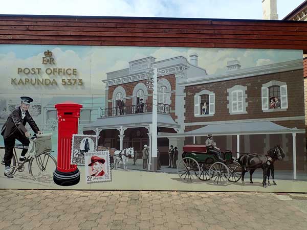 |
| Two of the old buildings in Kapunda | A mural in Kapunda |
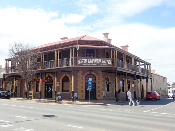 |  |
| The North Kapunda Hotel | A mural on the side of a building |
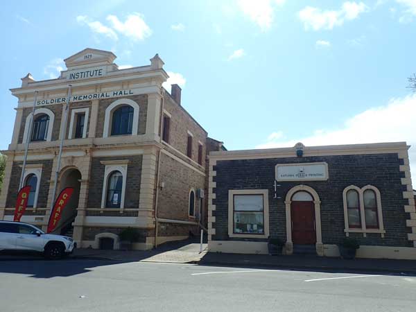
I have breakfast and fill my water tank and containers (I regularly move water from the containers to the tank in the car). I say bye to Kylie and leave at 10:30 am. I am travelling today to Mannum and from there across into Victoria. I head first to Kapunda where I arrive at 11:10 am (47 km).
Kapunda is an old copper mining town. There is high cloud and it is cool (17ºC) and windy. I walk around town, two nice hotels, some murals. Apparently Sir Sidney Kidman, the famous pastoralist lived here.
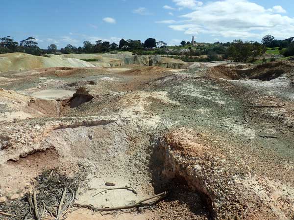
At 11:45 pm I drive the short distance to the old mine site (very poor signage once you get off the main road). There is a 1.7 km walk around the old mine, past the buildings and remains and around the mine. It is very well interpreted and quite interesting. Well worth stopping to see.
 | 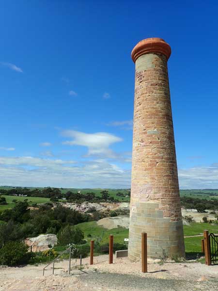 |
| Part of the Kapunda mine diggings | The chimney at the mine |
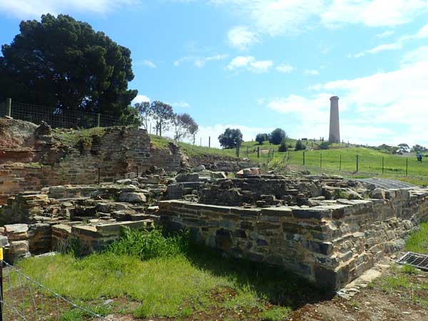 |  |
| Some of the ruins at the Kapunda mine | A sculpture at the Kapunda mine |
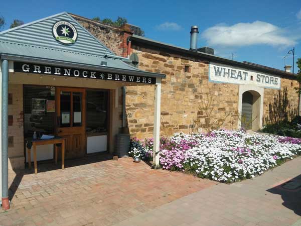
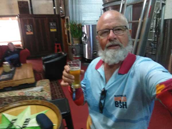
I leave at 12:30 pm. Fifteen minutes later while passing through Greenock I see a brewery. This is Greenock Brewery, so I stop. I have a small 200 ml Blonde Pilsner and then an IPA, both $4.50. Very nice! I buy a six pack of the IPA to take home. I leave at 1:15 pm and have lunch in the nearby park. There is also camping here, looks good. I leave at 1:35 pm and at 2:03 pm I stop at Eden Valley Lookout. There are great views out over the lower lands. It is blowing a gale.
 |  |
| The Greenock Brewery | One of the ponies of beer I taste |
As I leave the lookout, I see some fallen timber on the side of the road so I stop and cut some. I leave at 2:17 pm. I stop again at the Point Palmer Lookout which has views over Palmer and the Murray River. I only stop to take photos and then head to Mannum.
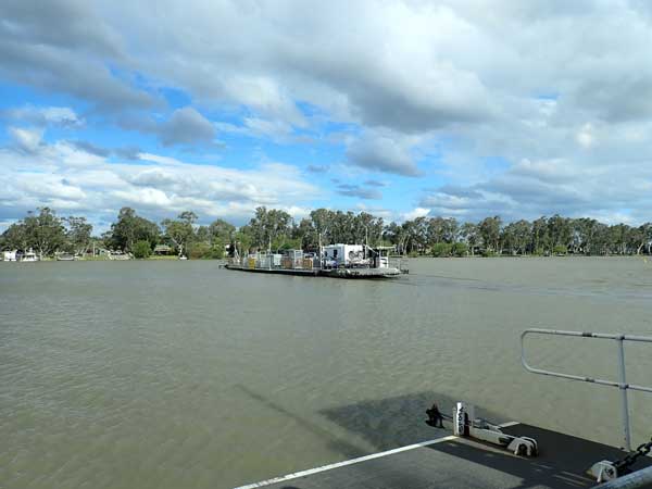
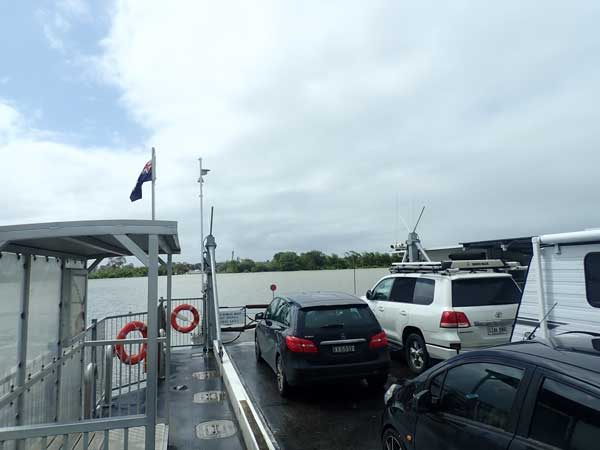
I am camping here in the Bolto Reserve. This is on the eastern side of the Murray River, so you have to cross over via the ferry. I get to Mannum at 3:05 pm and at the reserve at 3:25 pm. It costs $10 a night to stay here.
 |  |
| The ferry across the Murray River at Mannum | My campsite in Bolto Reserve at Mannum |
I find a spot but do not set up straight away as it is very windy. There are quite a few vehicles here, mostly caravans. I have a cuppa and read, and then another cuppa. The wind drops a little about 4:45 pm so I set up camp then.
At 5:30 pm I start a fire in my firepit and have drinks. I cook chicken fillets and potato on my skillet. Some of the timber I cut today has termites in it so I have to pull it all out and spray it. Some I had was also a bit green even though it looked good.
The wind drops totally by 6:30 pm. It is cloudy and cool. I go to bed at 9:35 pm.
Weather: Cloudy, maximum of 17ºC
Arrived: Bolto Reserve, Mannum Time: 5:25 pm Distance: 149 kilometres
Day 90 â Monday 20 September 2021 â Bolto Reserve to Tooleybuc
Weather: minimum of 8.9ºC and fine
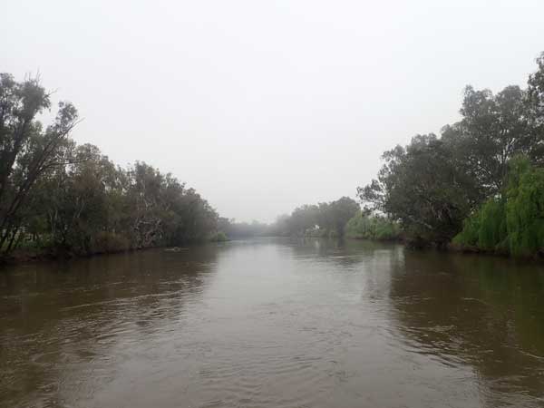
It starts raining at 1:00 am, heavy for 15 minutes and then light till 2:00 am. I sleep till 6:30 am. After reading the paper and listening to the news, I get up at 7:45 am. It is cold with a south-westerly wind, even though the sky is clear. I have breakfast and then walk along the levee bank to the south for about 900 metres. I leave about 9:30 am and cross back over the river on the ferry.
I go into town and buy some food ($18), some eye drops and a wine cask ($15). It starts raining about 10:10 am. Five minutes later I move from the main street down to the waterfront to look at the paddle steamer there. I leave at 10:21 am.
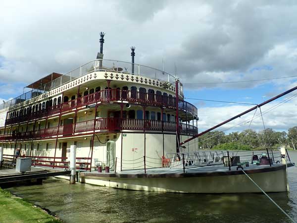 | 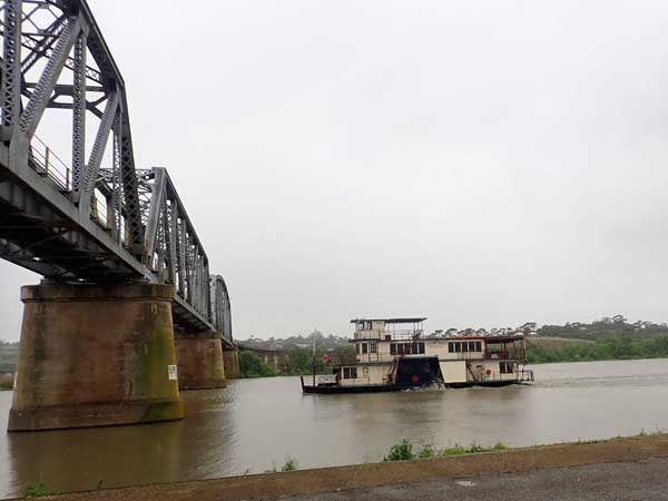 |
| The Murray Princess paddlewheeler at Mannum | The Captain Proud paddlewheeler at Murray Bridge |
I arrive at Murray Bridge (35 km) at 10:48 am and then go onto Tailem Bend. I cross the Murray River again on the ferry. This is where the river goes into Lake Alexander which then exits into the ocean. I go to Wellington to try and see Lake Alexandria. I go a fair way but cannot see the lake as it is too flat. I turn around and go back to Wellington. It is still raining on and off. I cross the Murray again, this time on the Wellington ferry (12:17 pm).
I go back to Tailem Bend and stop in the main street and get a pie from the bakery. It is nice. I have it in the park outside the old railway station. It is miserably cold, 12ºC but not raining. I leave at 12:50 pm and head east on the Mallee Highway. I arrive in Parilla at 2:10 pm (234 km). I had thought about staying here, but it is way too windy. I go to the toilet and leave five minutes later.
I originally had plans to stop a few nights as I cross Victoria but the wind is so strong I am now going to keep going till I reach the Murray River as I figure I will be able to get good protection there in amongst the river red gums. As I cross into Victoria there is no checkpoint but going back into South Australia the Police are stopping all vehicles. At 3:35 pm I stop at Underbool for another toilet break. The wind is less here, but it is still cold.
 |  |
| The ferry acroos the Murray River at Wellington | The Murray River at Wellington |
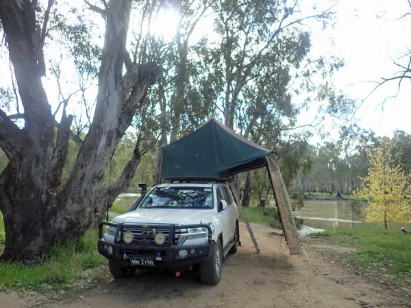
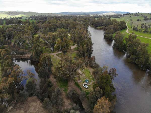
Back on the road, I continue east and at 5:10 pm I arrive at Tooleybuc (which is actually in NSW). I am staying at the Tooleybuc Bridge Reserve which is in Victoria, so on the western side of the Murray River. I turn just before the bridge and go down the track past some people and find a great spot right on the river. I set up and then start a fire.
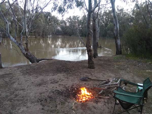 | 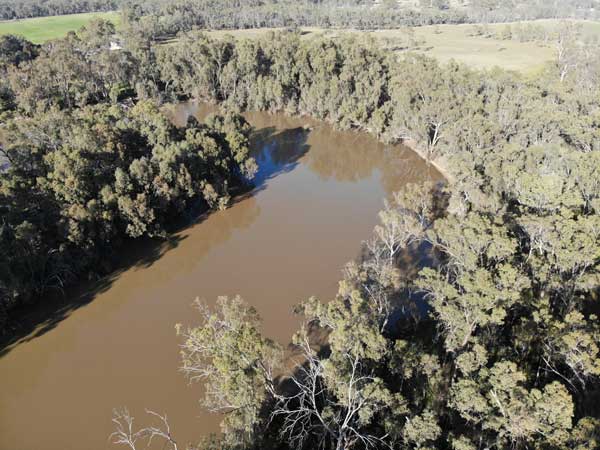 |
| My campsite in the Tooleybuc Reserve | A drone shot of the Murray River at Tooleybuc |
I heat water and then have a nice shower. The fire is now going good so I sit and have a beer or two. It has not rained since Tailem Bend and the radar shows little rain and none near here. As I predicted, the trees protect me from the wind. The river is really flowing. This is a great spot, I wish I could stay a few days. I have some cold chicken winglets from a few nights ago.
It is cold, 5ºC, and clear at times with an almost full moon. I go to bed at 9:15 pm.
Weather: Raining, maximum of 13ºC
Arrived: Tooleybuc Time: 5:10 pm Distance: 497 kilometres
Day 91 â Tuesday 21 September 2021 â Tooleybuc to Darlington Point
Weather: minimum of 1.2ºC and fine
All times now NSW time.
It is a very cold night and the wind totally drops. I am awake at 6:00 am. I later read the SMH till 7:45 am when I get up. I fly the drone and then have breakfast. It is now 4ºC. The wind later picks up a little. I pack up and leave at 9:25 am.
I cross the river and stop at the park to use the toilet. I leave at 9:35 am and at 10:10 am I stop in Balranald to fill up. I take 103.7 litres at $1.479 for a total of $153.44. This is an average of 11.8 l/100 km for the 879 km since Port Pirie. I leave at 10:20 am and travel via the Sturt Highway.
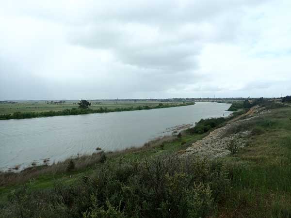
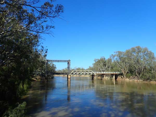 |  |
| The Tooleybuc Bridge | The Murrumbidgee River in flood at Hay |
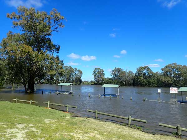
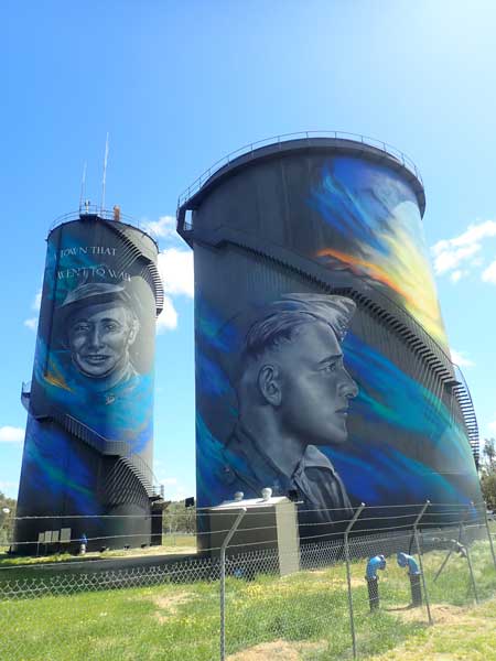
I stop at Willowvale Rest Area for morning tea. It is a cool 14ºC and I leave at 11:00 am. I arrive in Hay at 12:03 pm and go to look at the World War II murals on the water tower. There are soldiers and a nurse, very well done. I then go to Sandy Point Primitive Camping Area (183 km) which is on the Murrumbidgee River. This is a really good camping area, although the area is not right on the river.
The river is really flowing and in minor flood. The picnic tables on the lower bank are almost totally under water. I have lunch here. I leave at 12:50 pm and go via the northern side of the Murrumbidgee River rather than the Sturt Highway south of the river. I have not travelled this side of the river except for the section till near Carrathool. On the way I have a look at a few free camping areas. I do not intend staying at them, I just want to check them out. There are some good spots, but most are too wet to use.
 |  |
| Some of the murals on the water tanks at Hay | My campsite at Darlington Point |
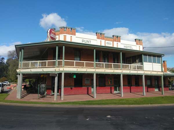
I arrive in Darlington Point at 2:30 pm. I go to the Murrumbidgee Regional Reserve which is on the northern side of the river. I go down a track a fair way but cannot find any spot flat enough and dry enough to camp. I go to the town (2:50 pm) and head out to Common Beach which is on the southern side of the river. There are only a few caravans here and I go past them but come to a flooded section of track. I go back a little and find a nice spot on a bend on the river. I set up at 3:00 pm and then walk back to town.
It is 1.5 km to the Punt Hotel. I have a beer ($6) and then walk back to the car. I collect some firewood on the way back. I walk 3.5 km all up and get back at 4:40 pm. I start a fire and put a green curry beef in my small camp oven and start cooking it. I then have a shower. At 5:30 pm I have drinks and then the curry with some steamed rice. Excellent!
 |  |
| The Punt Hotel at Darlington Point | Another beer, this time in the Punt Hotel |
There must have been a good camp site on the other side of the river as later a car and trailer stop there for the night. I must have missed the turnoff. The wind drops as it has most evenings, so even though it is 8ºC, it is not too bad. I go to bed at 9:45 pm.
Weather: Fine, maximum of 15ºC
Arrived: Darlington Point Time: 3:00 pm Distance: 311 kilometres
Day 92 â Wednesday 22 September 2021 â Darlington Point to Sandy Beach, Wantabadgery
Weather: minimum of 4.8ºC and fine
Once again I travel via the northern side of the river. I travel via Leeton and Narrandera. I stop at 10:25 am to cut some timber (86 km). I am back on the road 10 minutes later and at 10:45 am I arrive in Grong Grong. I have morning tea in the park which has toilets and showers. This has a sign saying it is a free camping area but another saying no parking on the grass. Hard to see how people could camp without parking on the grass unless they only have a tent.
 | 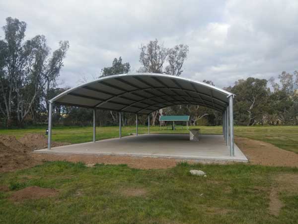 |
| The Royal Hotel at Grong Grong | The new shelter shed at Sandy Beach |
I cross the railway line and have a look at the hotel but it is closed (I read a few months later that the community now owns it and it has reopened). I head via Coolamon to Wagga Wagga. I arrive there at 12:12 pm (187 km). I go to The Good Guys to look for a new mobile phone. As all the shops in Sydney are closed due to the lockdown, I cannot actually check out the model I want before buying unless I do it here. I am after a Nokia X20 but they do not have one here.
I go to JB Hifi and find that they have it. I purchase it. I then go to the local park and have lunch. I leave at 1:30 pm. I again travel on the northern side of the river and go to the Sandy Beach Reserve at Wantabadgery. I have been here before, in 2012 with Kelly. I arrive at 2:10 pm.
It is a bit wet in spots so there are not as many sites available as normal. There is a large group of families at the eastern end, so I go right to the western end. I get a spot next to a table. I set up and have a shower while the engine is hot. I then have a cuppa. I hear more information on the radio about the earthquake that hit Victoria this morning at 9:15 am. It was 5.9 and near the town of Mansfield. Apparently it was felt well into NSW, but I was probably in my car. In 2012 Kelly and I felt an earthquake south-east of Melbourne. We were on the Murray River and it shook our campsite a great deal.
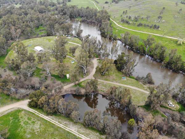 |  |
| A drone shot of Sandy Beach, my car right side | A closer shot of the section where I camped |
It comes over cloudy and I go for a walk around the reserve. There is a brand new huge covered area down near the existing large covered area (where Kelly and I camped in 2012 as it was raining). I also see that there is a really nice spot over a small gully near me but it is flooded.
I come back and have another cuppa and put the fire on. I cook sausages and sliced potato on my skillet over the fire. By now it is clear again and no wind at all. I also make arrangements to collect Veto from Kelly on Saturday morning. It is a cold 7ºC when I go to bed at 9:45 pm.
Weather: Fine, maximum of 15ºC
Arrived: Sandy Beach Time: 2:10 pm Distance: 232 kilometres
Day 93 â Thursday 23 September 2021 â Sandy Beach to Kareela
Weather: minimum of 2.7ºC and foggy
Another cold night. I wake at 4:40 am and end up reading most of the time till 6:05 am when I fall asleep for a bit. I then read the SMH and listen to the ABC Radio news. I get up at 8:00 am and it is 4ºC. I have breakfast and then leave at 9:00 am.
 |  |
| A foggy morning | The Murrumbidgee River as I cross it east of Sandy Beach |
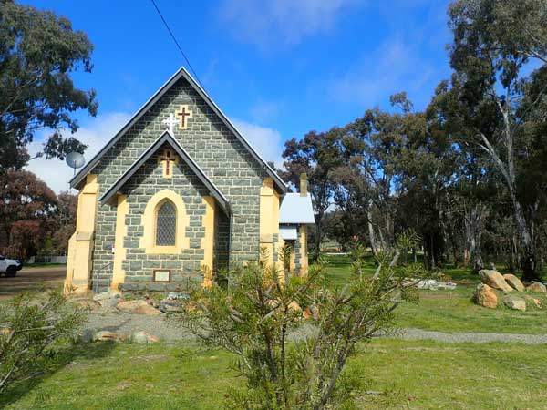 | 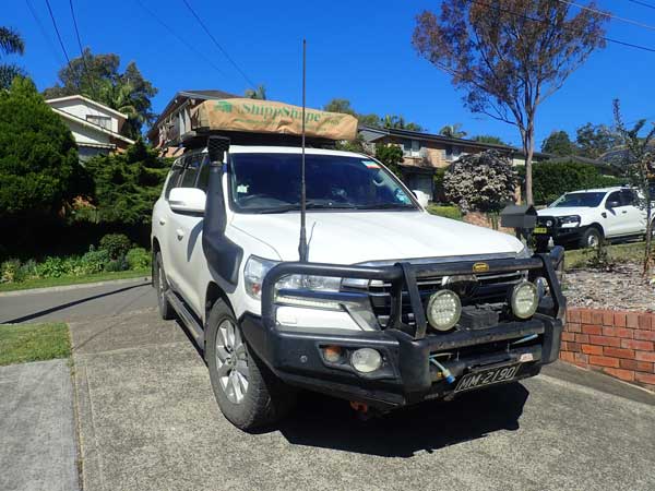 |
| A church at Bookham | The LandCruiser back home at last |
I stop at Bookham (112 km) at 10:20 am. There is a nice rest area here which I have never stopped at before. I have morning tea and leave at 10:30 am. I stop for lunch at Gordon VC Rest Area (288 km) at 12:18 pm. I leave at 12:30 pm and travel via Appin and arrive home at 1:57 pm.
A few days later I refuel again, I take 114.6 litres at $1.439 for a total of $164.98. I averaged 12.0 l/100 km.
Weather: Fine, maximum of 21ºC
Arrived: Kareela Time: 1:57 pm Distance: 410 kilometres
SUMMARY
Even though this started off as a six week holiday, it ended up lasting for 13 and a bit weeks due to the severe Covid lockdown in Sydney which would have meant I basically could not have done much at all. I end up seeing a lot more of Queensland than I planned, but it all turned out great. Travelling alone for all but the first three weeks was a bit lonely, but I did meet a lot of people in some places.
Statistics
Days: 93
Distance: 13,265 kilometres
Fuel used: 1,744 litres
Fuel cost: $2657.83
Fuel consumption: 13.1 litres per 100 kilometres
Camping costs: $612
Tours: $530
Meals: $432
Food: $1035
Washing: $50 approx
Takeaway drinks: $420
Other: $110
Cash spent: $650
TOTAL: $6497 which is about $500 a week
Note: Does not include food and drink costs purchased before departure |  v6.00.307 © 2003-2005

