|
CENTRAL AUSTRALIA TRIP - AUGUST 2010 - PART 1 - SYDNEY TO THARGOMINDAH
While I have been to Central Australia before (in 2003 - Click here to read article), Kelly had never been past Orange till we did our western NSW trip in 2006. A couple of years ago we decided to head there in 2010 and after a lot of planning, we planned to set out on the last day of July 2010.
However, as can often be the case, a very large spanner was thrown in the works a few days before our departure. On Wednesday 28 July 2010, my father John Samuel McFadyen, died very suddenly. The funeral was scheduled for the next Wednesday so we decided to leave on the following Saturday or perhaps the Friday if we could manage it. The funeral went smoothly and as I have two brothers and two sisters who could comfort Mum and look after things, we were able to get ready to leave on Friday 6 August 2010.
We were in our 1999 Toyota LandCruiser Prado (click here to see more about our car). With us were our diving buddy, Peter Flockart in his Nissan Pathfinder. Travelling with Peter was Kelly's Dad, Tomas Jandik. Also on the trip was another diving buddy, Peter Trayhurn, with his eight year old Melanie and four year old Keith. They have a Toyota LandCruiser Troopie with a pop-top camper set-up.
ROUTE MAP
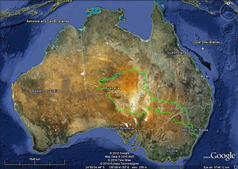 |
| Our route as recorded by our GPS using OziExplorer and uploaded to Google Earth - we went anti-clockwise |
Our plan was to head up though NSW to southern Queensland and then across to South Australia. From here we planned to head north back into western Queensland and then into the Northern Territory. However, rain in Queensland in January and February 2010 caused us to change plans a little as some places were still flooded when we set off in early August. In addition, about 75 mm of rain fell on 6 and 7 July 2010 and another 20 mm or so on about 15 July 2010 causing more problems. To be honest, if we had left as planned, we would have struck problems at the start as well as three weeks into the trip.
ROUTE DOWNLOADS
You can download the Google Earth track of this trip by clicking here and looking at it in Google Earth.
Day 1 - Friday 6 August 2010 - Sydney to Walgett
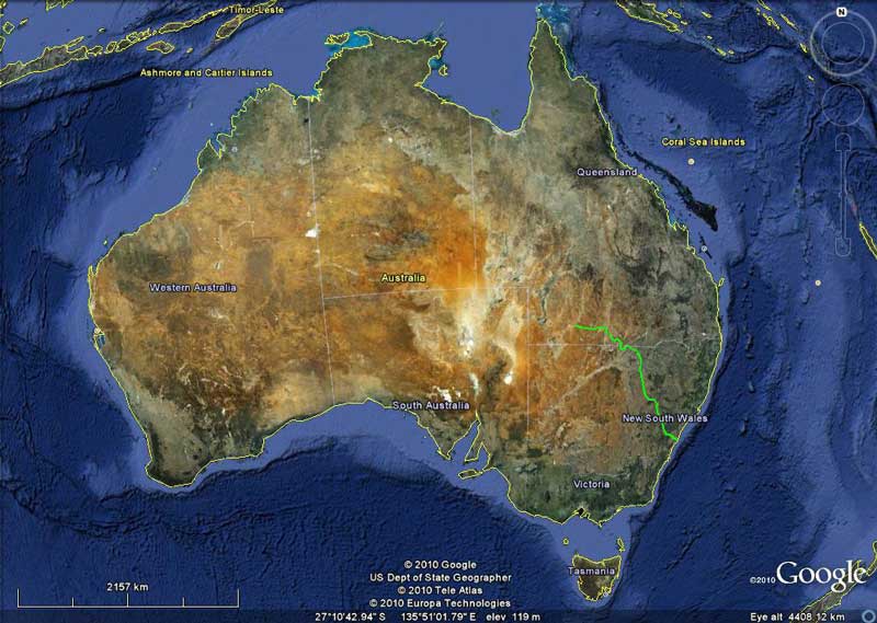 |
| Part One of our trip, Sydney is bottom right end of track and Thargomindah top left |
We head off at 6:10 am, a little later than our planned departure time of 6 am. Today is going to be a long drive, so we want to get away early. Peter and Tomas have stayed at our place so we leave together and head via the M5 and M7 to the M4. Apart from a stop at a bakery in Lawson (where we always stop heading west to get bread and some breakfast), we do not stop. The Great Western Highway at Lawson is being widened and there is now a nice parking area behind the highway with toilets. It is very cold here, only 6ºC. It is even colder at Blackheath, only 2.2ºC.
Once over the Blue Mountains we drop down the other side and just past Lithgow we take the Mudgee Road. This is the Castlereagh Highway and we will stay on this for most of today and tomorrow. At a little village called Ilford, we stop for morning tea at 9:35 am at a nice little picnic area. There are shelters and tables as well as toilets. We leave at 9:55 am with Kelly now driving.
 |  |
| Our Prado as we leave home | Some of the murals and ads at Mendooran |
I should add that Peter T (as I will call him) has not left Sydney on time and will be many hours behind us. He is not the most organised person on Earth and it will not be the last time he travels apart from us.
We travel via Mudgee, Gulgong, Dunedoo and Gilgandra. At 10:35 am we stop at Mudgee to buy some bread sticks (which the Lawson bakery did not have) to use with dinner tonight from the Woolworths. At 12:20 pm we pass through Mendooran. There are lots of murals on the buildings as well as some ancient advertisements. At 1:10 pm we stop on a side road a few kilometres out of Gilgandra (we did not see anywhere to stop there - eg a park) for lunch. It is still quite cold, only 12ºC and windy.
We leave at 1:30 pm and head north towards Walgett. The roads are really good, so we keep up a good pace. When we do four wheel drive trips, we sit on 90 km/h when on normal roads and 100 km/h when on the freeways (like the F3 or M4). Experience has shown that we get much better fuel economy at these speeds.
At 3:20 pm, about 62 kilometres south of Walgett, we stop at a rest area. This has toilets and a nice picnic area. The lighting for the toilets at night time is provided quite ingeniously, you shine your car headlights at a metal mirror which reflects it to another mirror on the top of a pole which then shines down into the toilets. All along this section of road there are lots of black shouldered kites and black kites. We even see the first emu with chicks.
In Walgett we need to refuel. While I have two tanks that carry a total of 159 litres, Peter F's Pathfinder only holds 80 litres. He has two 20 litre Jerry cans for a couple of sections of the trip where he will be at his limit. We arrive at Walgett at 4:10 pm. After refuelling (we took 86.6 litres @ $1.369 per litre = $118.56), we head east out of town at 4:25 pm towards Narrabri and then north on the Moree/Lightning Ridge Road (Gwydir Highway).
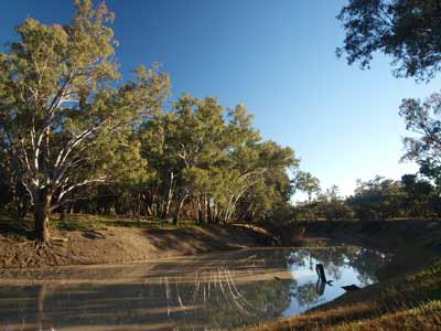 |  |
| The Barwon River at the Walgett Common | Our camp site at Walgett Common |
We plan to camp at the Walgett Town Common. I have not been able to find out much about this but using GoogleMaps I believe that I have found it. It is located on the banks of the Barwon River just north of where the highway crosses it. As soon as we cross the river we head off left down a track but find this is not a great spot. We return to the highway and about 150 metres along there is another track off to the left. This leads to some great spots and we soon find a nice spot to camp. We set up camp at 4:35 pm.
There is a lot of timber around so collect some for the fire. We do not need to use the emergency wood I have bought along. Dinner tonight is a stew that Kelly cooked back at home and which we vacuum sealed. All we need to do is heat it up and serve with the bread sticks. This makes it a lot easier considering the distance and time we had to drive today.
As we have had a good run, we have a look around and take some photos of the river and then at 5 pm have a well-earned beer and some nibblies. Kelly heats up our dinner and we have nice feed under the gum trees.
It is a clear night and the stars are quite good (although a little blocked by the trees). We see four satellites and four shooting stars. We read after dinner and go to bed early at 8:30 pm. It has been a long day.
Weather: Fine with some cloud, max 15ºC Arrived: Walgett Town Common Time: 4:35 pm Distance: 686 kilometres
Fuel: 86.6 litres Cost: $118.56 Economy: 12.7 litres per 100 kilometres
Day 2 - Saturday 7 August 2010 - Walgett to Culgoa National Park
Weather: Fine, 2.7ºC and frost
It was a very cold night and I had to get up and put on tracksuit pants and a jumper! There is a slight frost on the ground when I get up at about 7:30 am. After breakfast, we pack up. As Kelly and I have a Shippshape car top tent, we are quickly packed. Peter and Tomas take a bit longer, mainly due to the fact that they are both using brand new tents which they have only tested once before. They are much quicker after a couple of days.
We leave camp at 8:55 am and drive back onto the tar and head up the Castlereagh Highway towards Queensland. We are going to have a look at Lightning Ridge as none of us has been there before. Kelly and I have been to White Cliffs, another NSW opal mining town. Lightning Ridge also has hot thermal waters, so we plan to bathe in them.
 |  |
| The main street of Lightning Ridge | Kelly in the Lightning Ridge Spa |
Opal mining towns are always interesting, full of characters who have really lost touch with civilisation in most part. The Ridge is no different.
It is only 73 kilometres to the town and we are there by 10 am. It is a lot bigger than I had imagined. We drop into the visitor centre on the way into town and after stopping to buy a bed roll for Tomas and a quick look around town, we head to the free hot artesian spa. Magic, the water is about 40ºC. There are also excellent toilets and showers so we freshen up after the spa. We then have morning tea.
 |  |
| A small part of Amigos Castle | The Astronomers Monument |
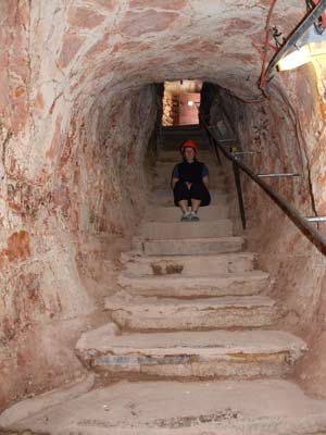
We do a short tour of the opal fields near the spa using the Red Car Door tour (this follows car doors painted red - map from the visitor centre - there is also a Blue Car Door tour). There is Amigos Castle which is a huge castle-like structure built of rock and concrete (started 1983 but not finished). There is also the Astronomers Monument built by an obviously deluded Polish bloke called Alex. Very strange. He died when aloe vera and tequila he was fermenting exploded!
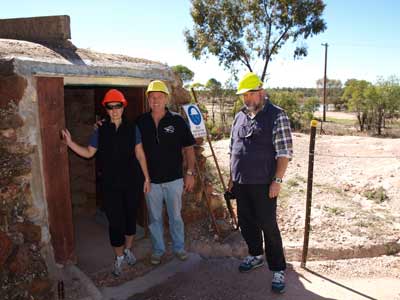
We also do the Blue Car Door tour and end up at a mine that you can enter. This costs $16 each, a bit rich, but gives an experience of a real mine. We need to go to the excellent IGA supermarket as we leave so we can get a couple of things we have forgotten.
 |  |
| Kelly, me and Peter F at the entry to the opal mine | Kelly inside the opal mine |
We head back to the highway and continue north. Our next stop is the banks of the Narran River where at 1:55 pm we stop for lunch. This is 33 kilometres along towards Goodooga. We leave at 2:12 pm and continue to Goodooga. About 25 years ago it was voted NSW's most boring town. It is only 73 kilometres drive from Lightning Ridge. We go to the Goodooga Telegraph Hotel (2:45 pm) and have a beer (this is something you will notice us do a bit - stop at quaint little hotels for a single beer).
After the beer, we depart at 3 pm and head north-west on a road that goes into Queensland. We are on our first dirt road for the trip. Our destination for tonight is not actually in Queensland, but we need to go over the border and then come back into NSW. We are heading for Culgoa National Park. There is very little information available on the internet about this national park.
In February 2010 all this area was flooded, with the Culgoa, Bokhara and Birrie Rivers flooding. There has also been more recent rain and as such, the roads are not in the best of condition. There are a lot of dried ruts on the roads and the sides are very wet. There are also sections of water across the road. About 1.5 kilometres after crossing the Culgoa River, Kelly gets bogged for a few seconds but manages to get out okay once she engages low range.
 |  |
| The Telegraph Hotel at Goodooga | Winching Peter F back onto the road |
Just after this at 3:20 pm, Peter F miscalculates the road after bottoming out on dried mud in between the ruts and bounces and slides off the road into a bog. We have only just got out of the bog when we respond to his radio call by turning back. He is 1.2 kilometres behind us. We end up winching him out using the new Aldi winch I installed only a few weeks ago. This was a better option than trying to snatch him. The winch works great. We are back on the road at 3:41 pm.
There is a camping area in Culgoa National Park on the Culgoa River. The best access from the direction we are coming from is this way. From Bourke or Brewarrina you can come in the opposite direction (which we may use tomorrow to leave the park). Once in Queensland we have to take another road but there is no sign pointing to the NSW Culgoa National Park, only the Queensland Culgoa Floodplains National Park. On the DECCW web site this is called West Culgoa Road but on maps it has no name.
 |  |
| Our camp site at Culgoa National Park | Another shot of our camp site |
We come to the Queensland Culgoa Floodplains National Park, I am sure many have been confused and stopped here thinking it was the NSW park. We continue on, this road seems to go on forever. There are lots of kangaroos and emus along the road. I have obtained a pdf file of a brochure that shows the location of the camping area. The turn off to this is located at GPS S29º 06.558' E146º 58.816' (using WGS84 as datum). The sign for the turn-off to the camping area is poor and we miss it at first. We arrive at the camping area at 5:15 pm. It has been slow due to the poor condition of the road.
We do not have much hope that Peter T will find us here due to the condition of the road and lack of signs. The visitor book shows that no-one has been here for the past almost two weeks. We set up camp
I start preparation for dinner while Kelly puts up the Shippshape. Tonight we are having a roast chicken dinner. I soon get a fire going as we need lots of coals. In addition, Kelly is cooking garlic prawns as an entree. We have some nibblies and a beer while watching the fire.
Kelly does her prawns and we have them with some crusty bread. Very tasty. At about 6:30 pm we have enough coals so I put the chicken on. This is a marinated and stuffed chicken we purchased from Woolworths. We have had these before on camping trips and they are very tender and tasty. To go with this we have roast potato, pumpkin and carrot which are coated with oil and bush spice.
At 7 pm we hear a car coming and then see driving lights. Well, blow me down, Peter T has found us! This is a relief as I really thought he might get lost.
By 7:30 pm the chicken and vegies are cooked. Another great meal! After dinner we watch the stars and then go to bed to read for a bit before going to sleep.
Weather: Fine, max of 17ºC Arrived: Culgoa National Park
Time: 5:15 pm Distance: 231 kilometres
Day 3 - Sunday 8 August 2010 - Culgoa National Park to Thargomindah
Weather: 1.1ºC and fine
It was even colder last night but there is no frost in the morning. We are up a bit earlier today as we have a fair distance to travel. It should be an easy drive as mostly it will be on tarred roads. We have breakfast and instead of leaving at 8:30 am as planned, we do a couple of short walks. We walk to the Culgoa River which has pools of water in it as it flooded after the Queensland rains in January and February this year. This is not a bad spot, with a bit of birdlife around. The coolibah trees along the river are fantastic. It only takes 20 minutes return and is not two kilometres as stated on the sign.
 |  |
| The Culgoa River at Culgoa National Park | A tree at Culgoa National Park at is said to be an Aboriginal scarred tree
Bark removed for making a shield or container |
The others go for the walk after we return and we drive the short distance to the Sandhill Track car park. This has a walk along a fire trail but we only do a short bit before returning to the car. Once the others get here, we leave at 10:03 am and head back to the road that comes through the national park. Once here we head to the left and south-west.
After leaving Culgoa National Park there is road off to the right. This will be a shorter journey (to Cunnamulla) but I am unsure if it is a decent road. I have decided that if the road has a sign to Cunnamulla, we will take this road. Otherwise, we will continue south-west to the Weilmoringle (shown on some maps as Neilmongle) - Jobs Gate Road. The road off to the right does not have a sign so we continue 18 kilometres to the Weilmoringle - Jobs Gate Road. At 10:30 am we turn right and head north-west and then north to Jobs Gate, the access point into Queensland.
 | 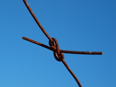 |
| A very old wire fence | A knot in the wire on the fence |
At 11:02 am we cross into Queensland (31 kilometres along). At 11:30 am we stop for morning tea on the side of the road. We are back on the road at 11:48 am and travel towards the Noorama Sports Centre. This is shown on maps and I had thought before leaving home "God only knows why there is a sports centre out here, almost 1,000 kilometres from Brisbane". As we pass, we see that it is a racetrack and some buildings. It looks like they might hold a picnic race here. It does not really seem to be a sports centre. The road is a single lane of tar from here on.
At 12:20 pm we cross Widgeegorara Creek which has a tar section of road as a causeway. There is a lot of water flowing over the road, but only an inch or so deep. The country side here changes to a flat plain.
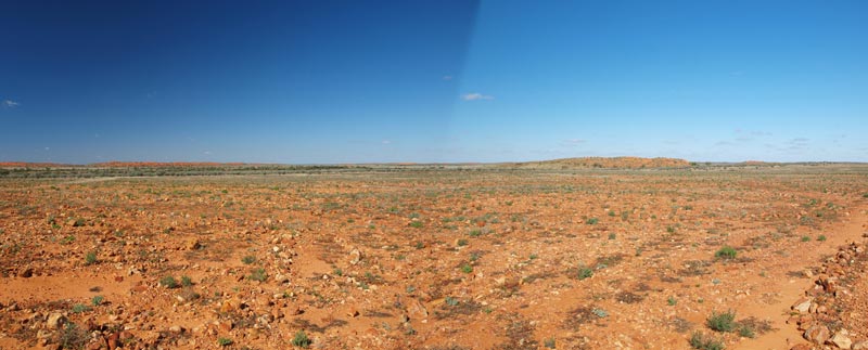 |
| The landscape between Noorama Sports Centre and the Mitchell Highway |
At 1:35 pm we arrive at the Mitchell Highway which comes from Bourke. Peter F and Kelly and I stop here for lunch. Peter T decides to go into Cunnamulla for lunch. We have only travelled 206 kilometres in 3.5 hours, of which 92 was in the last 70 minutes. After lunch, we leave at 1:55 pm and turn right. It is only 27 minutes to Cunnamulla.
At Cunnamulla, we stop and refuel (68.3 litres @ $1.429 a litre = $97.60). As it is Sunday and we are in rural Queensland, nothing at all is open. We head out of town on the Bulloo Developmental Road towards the west. This is mostly two lanes of tar (one each way) but some sections are only one lane.
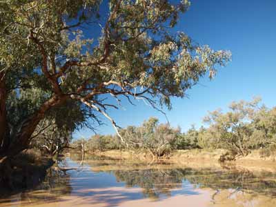 |  |
| The Paroo River at Eulo, lots of water | The Bulloo Development Road west of Eulo |
It is 199 kilometres to the next largish town, Thargomindah. We pass through Eulo which is very small. It is on the Paroo River, there is a very good camping site on its banks. We stop at some mud springs which are publicised on maps and by large signs, but it is very boring. It takes just under three hours to get to Thargomindah.
We had planned to get to Noccundra but the late start and poor condition of the roads in the morning mean we are behind schedule. As we approach Thargomindah we find a very nice camping site east of the western most branch of the Bulloo River. We camp on the south side of the road. You could fit about six cars here.
 |  |
| Our camp site next to the Bulloo River at Thargomindah | The Bulloo River Hotel at Thargomindah |
After setting up our campsite, we walk to the pub at 5:45 pm and have two middies of beer. For dinner we have a barbecue of sirloin steak and sausages with salad. We go to bed at 8:50 pm and read for a while. It is a warm night.
Weather: Fine, maximum of 22ºC Arrived: Thargomindah Time: 5:15 pm Distance: 450 kilometres
Fuel: 68.3 litres Cost: $97.60 Economy:13.9 litres per 100 kilometres
For the next part of this trip, click here.
|  v6.00.307 © 2003-2005

